Explore Some of Our Past Trips
What does each trip blog consist of?
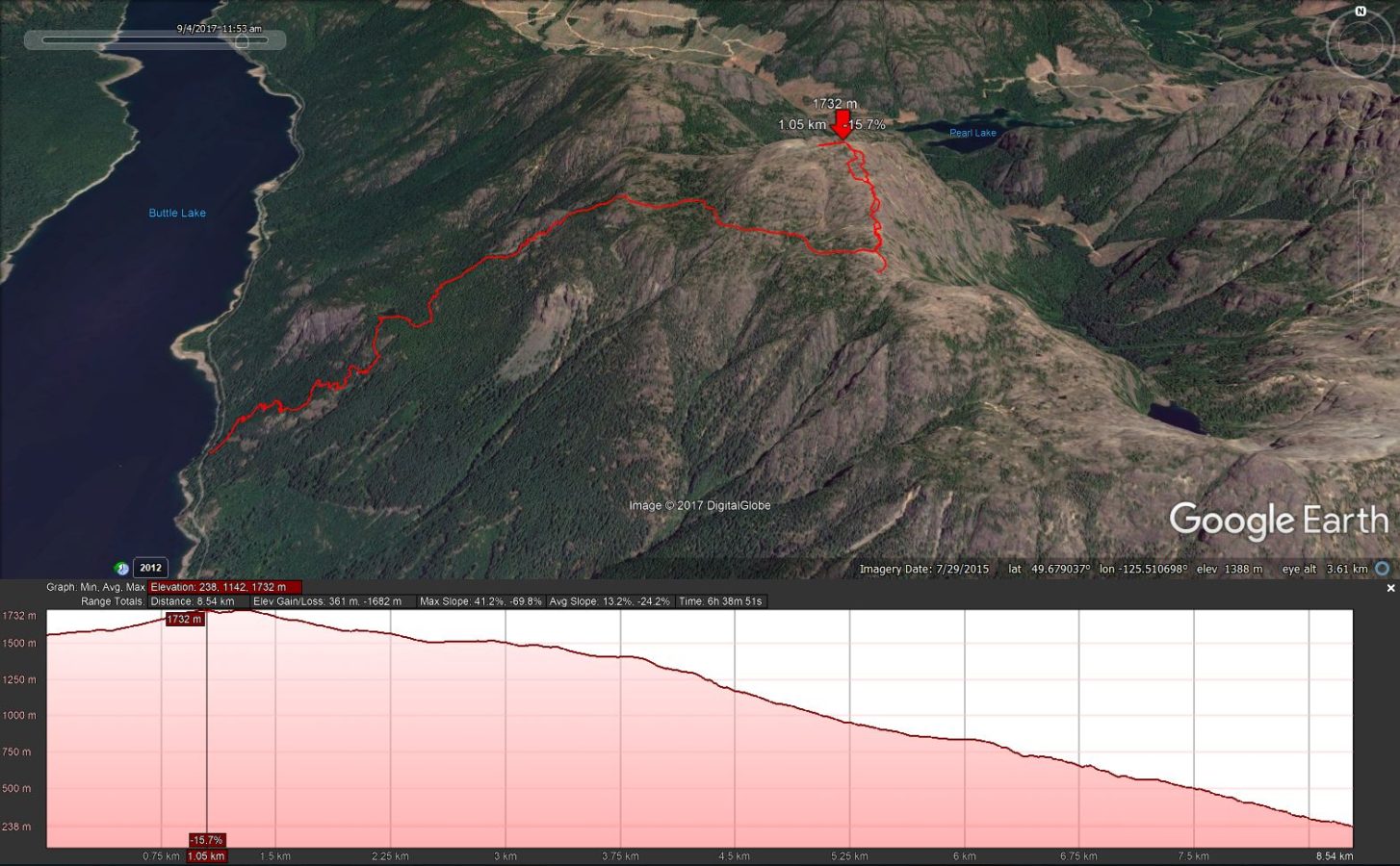
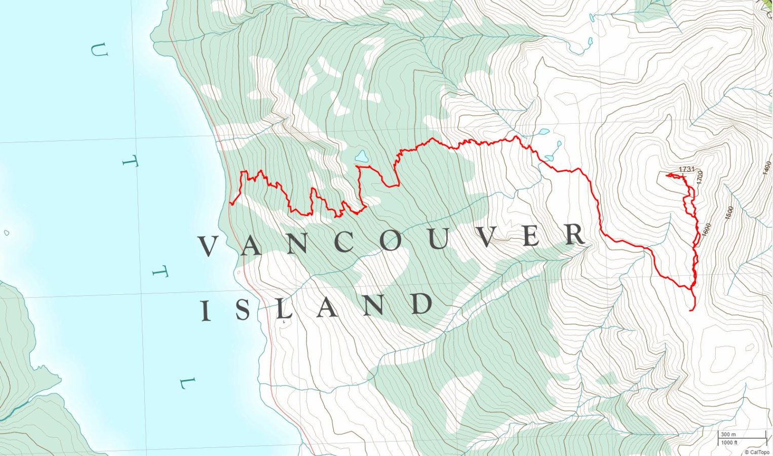
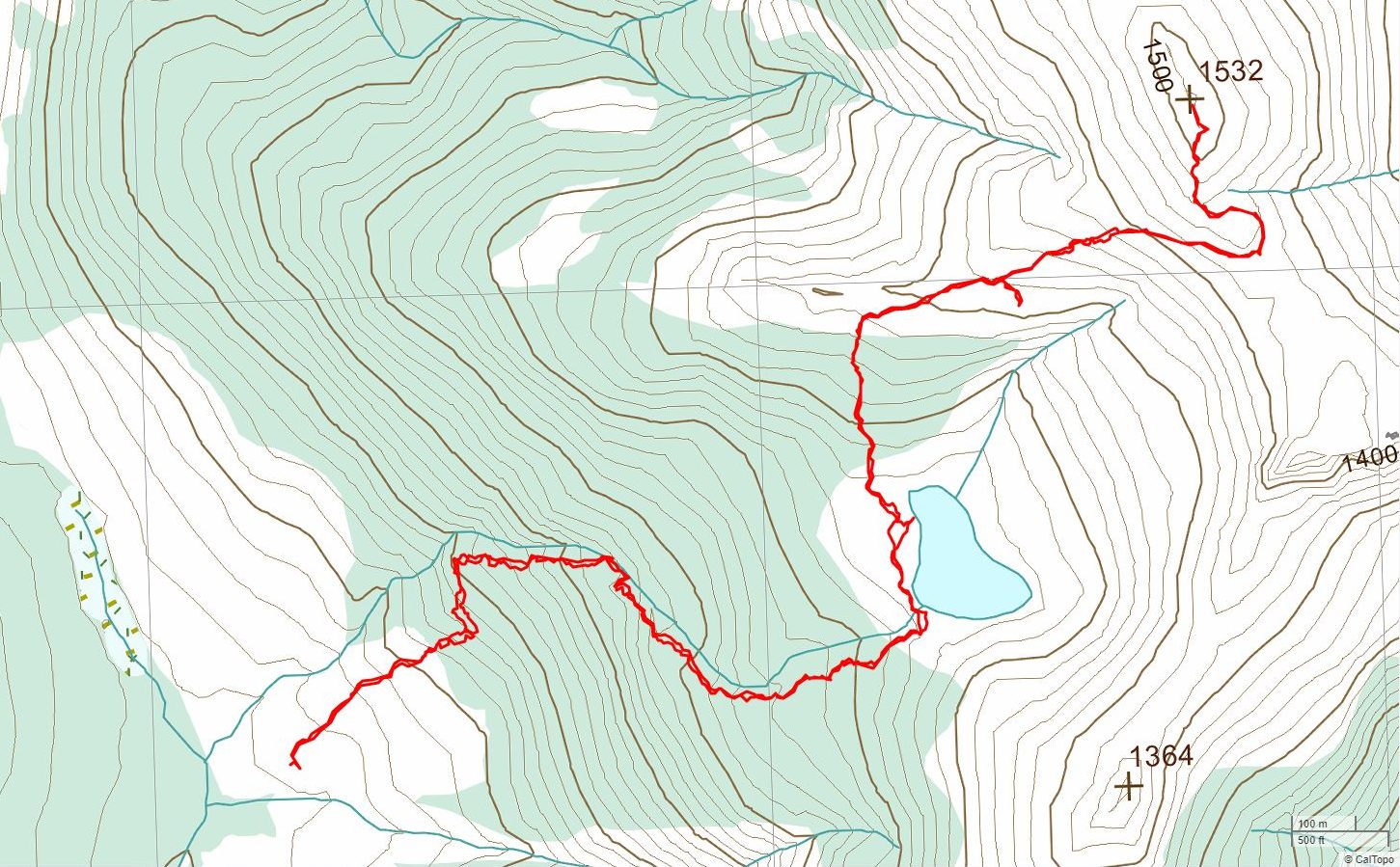
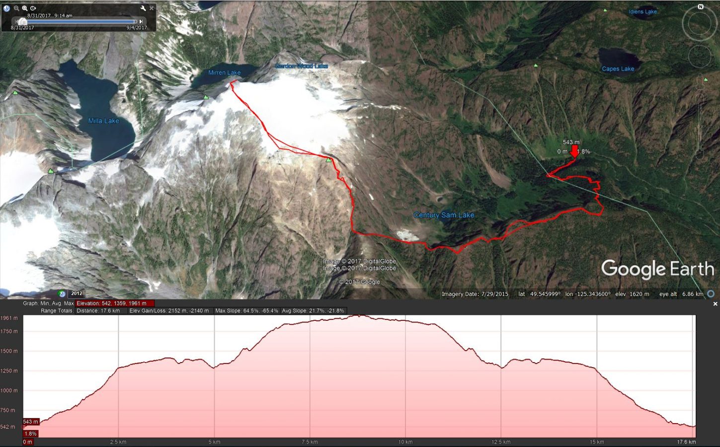
- A Google Earth image which highlights the trip route as a red track. The image also includes an elevation profile and an assortment of statistics.
- A brief description and summary statistics on the accompanying tabs.
- A link to Gaia GPS for an interactive full-screen topographical map and the ability to download a GPX file for your gps device.
- Some trips also include a virtual fly-over video of the hike (more to come!).
What does elevation gain/loss mean?
What are +/- and Max/Avg slope statistics?
What determines the degree of difficulty of any trip?
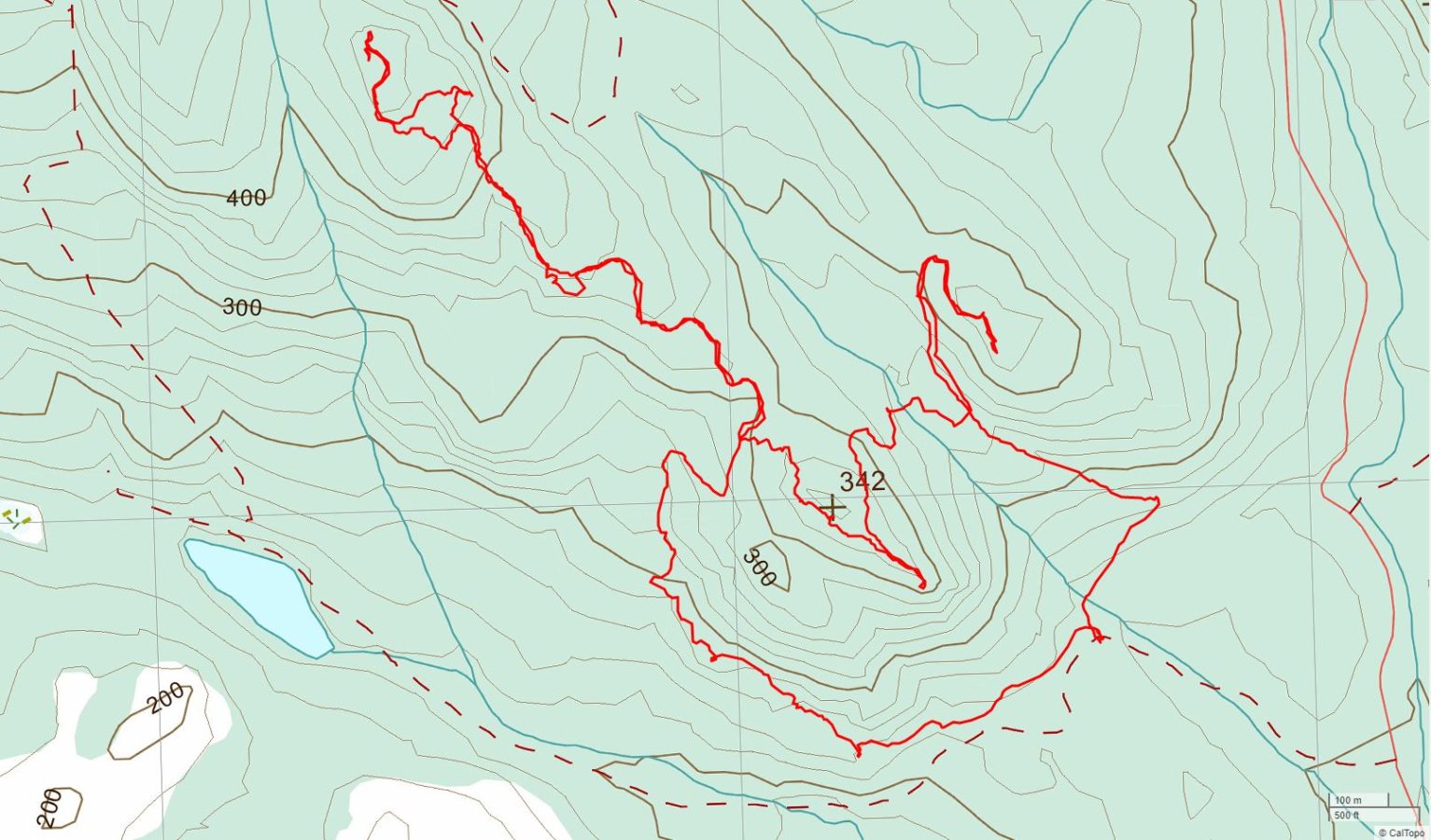
Cumberland Trails – Allen Lake Loop
A Fall Day Hike
Dec. 9, 2017
A day hike starting from Coal Creek Historic Park on Comox Lake Rd. in Cumberland. The hike follows a number of named trails ascending to Allen Lake and looping around to return via a different route.
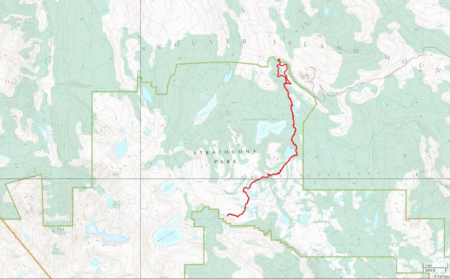
Topographical map and gpx file download at Gaia GPS.
| Distance | 9.3 km |
| Elev. Gain/Loss | 362 m, -363 m |
| Max Slope | 49%, -27% |
| Avg. Slope | 7%, -7% |
| Difficulty Rating |
Video fly-over pending.

Raven Lodge to Cruickshank Canyon Lookout
A Summer Day Hike
Sep. 16, 2017
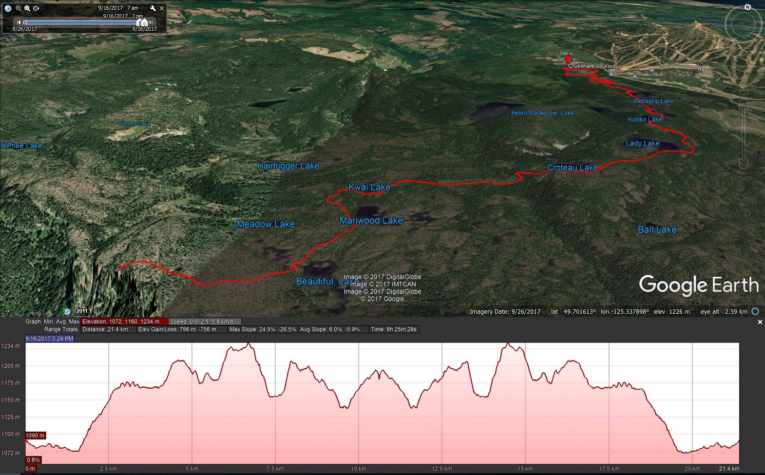
Topographical map and gpx file download at Gaia GPS.
| Distance | 21.4 km |
| Elev. Gain/Loss | 756 m, -756 m |
| Max Slope | 25%, -26% |
| Avg. Slope | 6%, -6% |
| Difficulty Rating |
Virtual fly-over video pending.
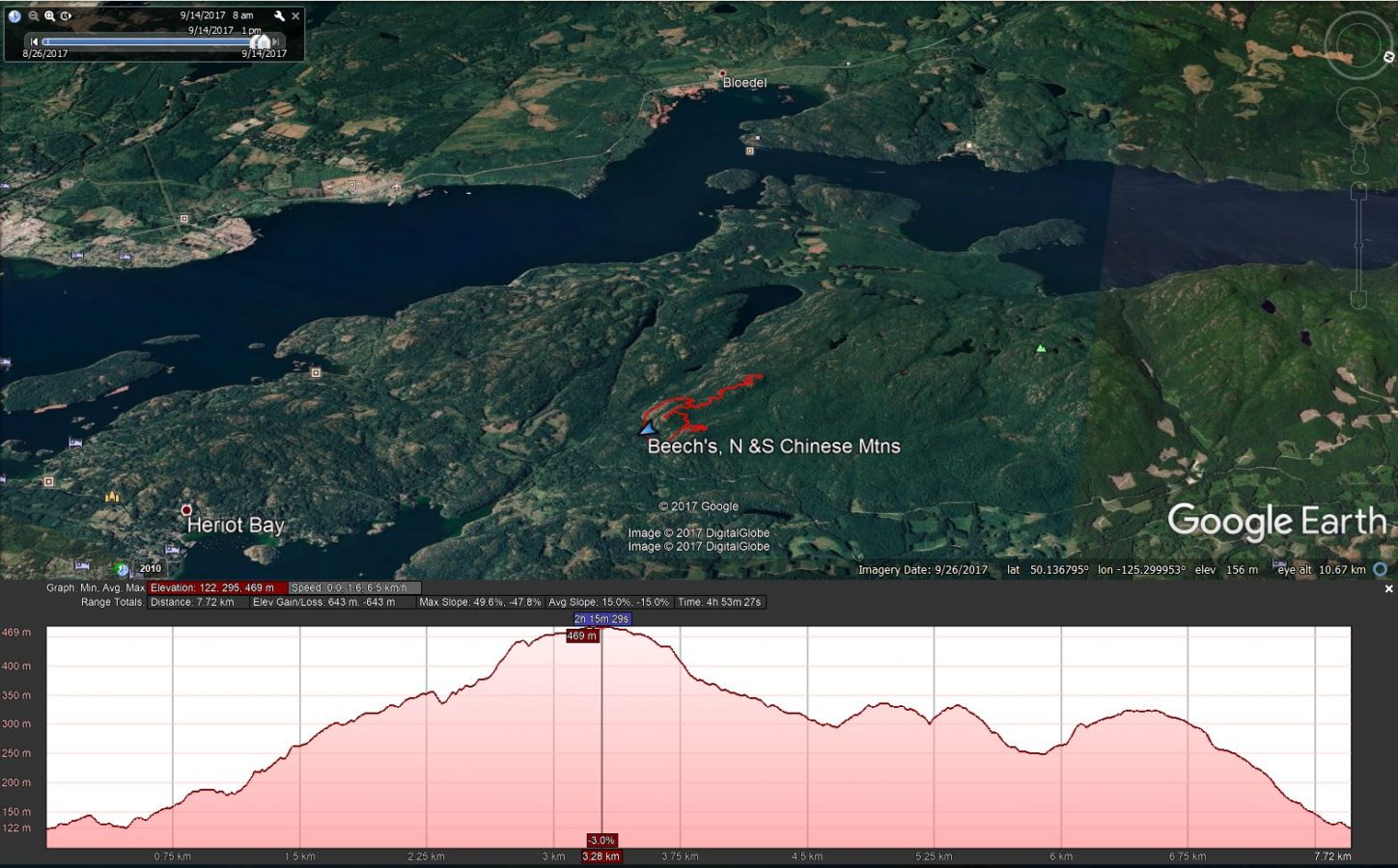
Beech’s, N. Chinese & S. Chinese Mtns.
A Summer Day Hike
Sep. 14, 2017
Topographical map and gpx file download at Gaia GPS.
| Distance | 7.7 km |
| Elev. Gain/Loss | 643 m, -643 m |
| Max Slope | 50%, -48% |
| Avg. Slope | 15%, -15% |
| Difficulty Rating |
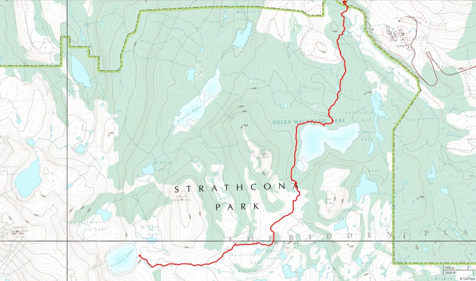
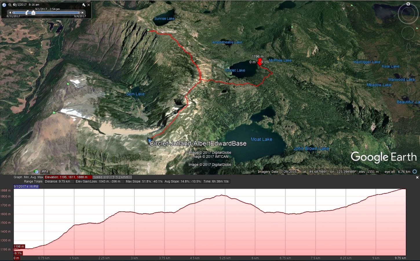
Raven Lodge to Buttle Lake
A Five-Day Summer Backpacking Trip
Aug. 31 to Sep. 4, 2017
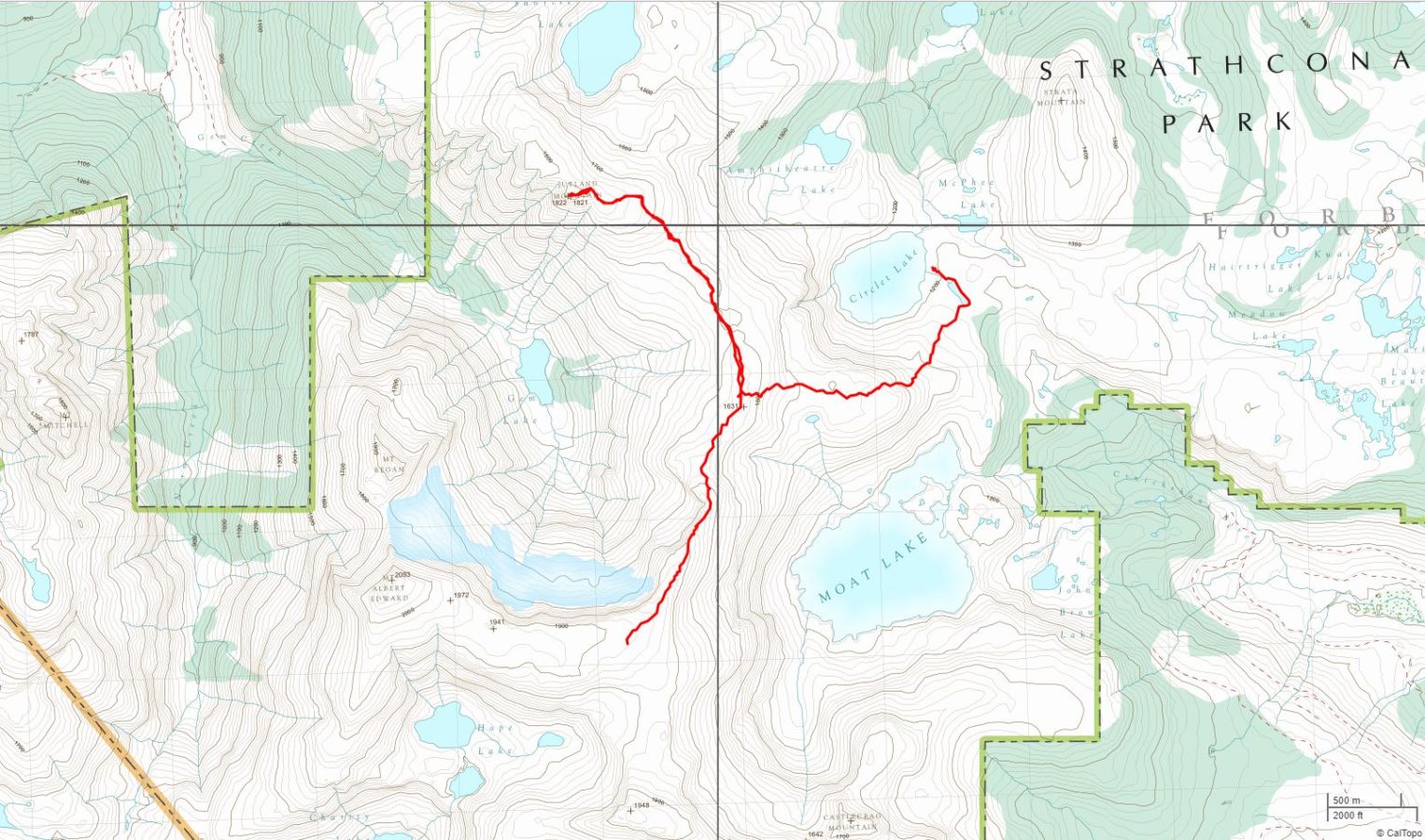

Day 1: From Raven Lodge to campground at Circlet Lake.
Topographical map and gpx file download at Gaia GPS.
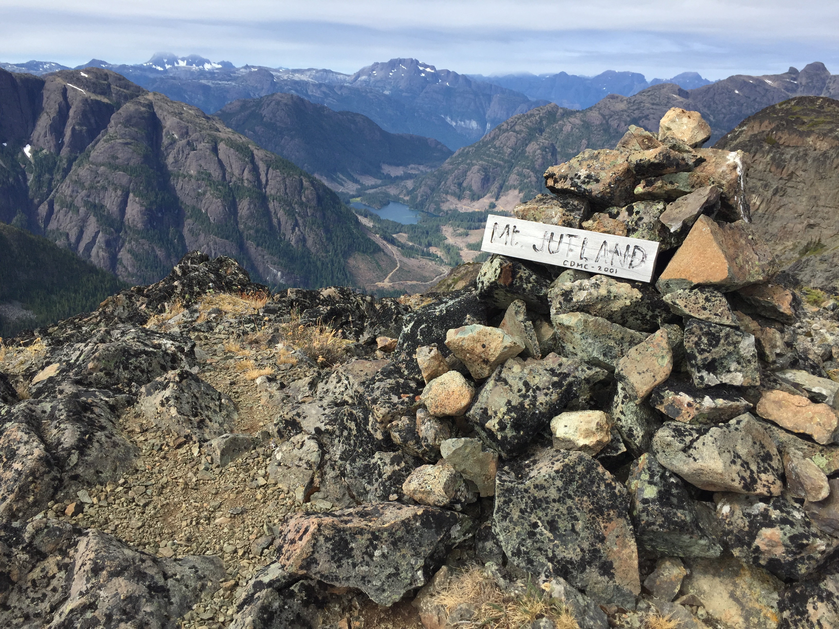
Day 2: From Circlet Lake climb to the top of the ridge, drop backpacks and ascend Mt. Jutland with day packs and return to pick up backpacks. Hike to camp at base of Mt. Albert Edward.
Topographical map and gpx file download at Gaia GPS.
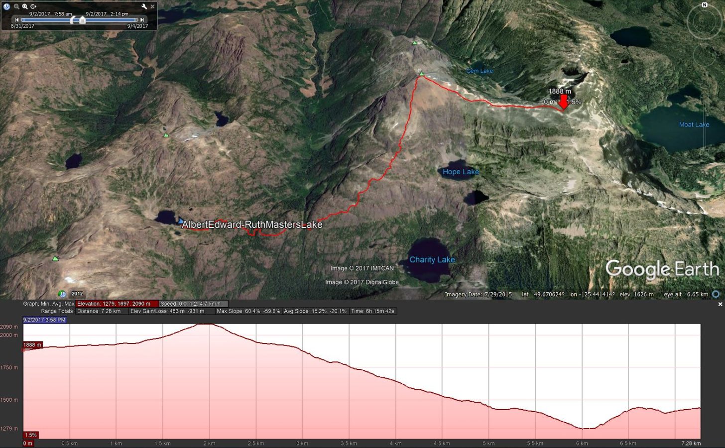
Day 3: Summit Mt. Albert Edward and continue on to Ruth Masters lake to camp.
Topographical map and gpx file download at Gaia GPS.
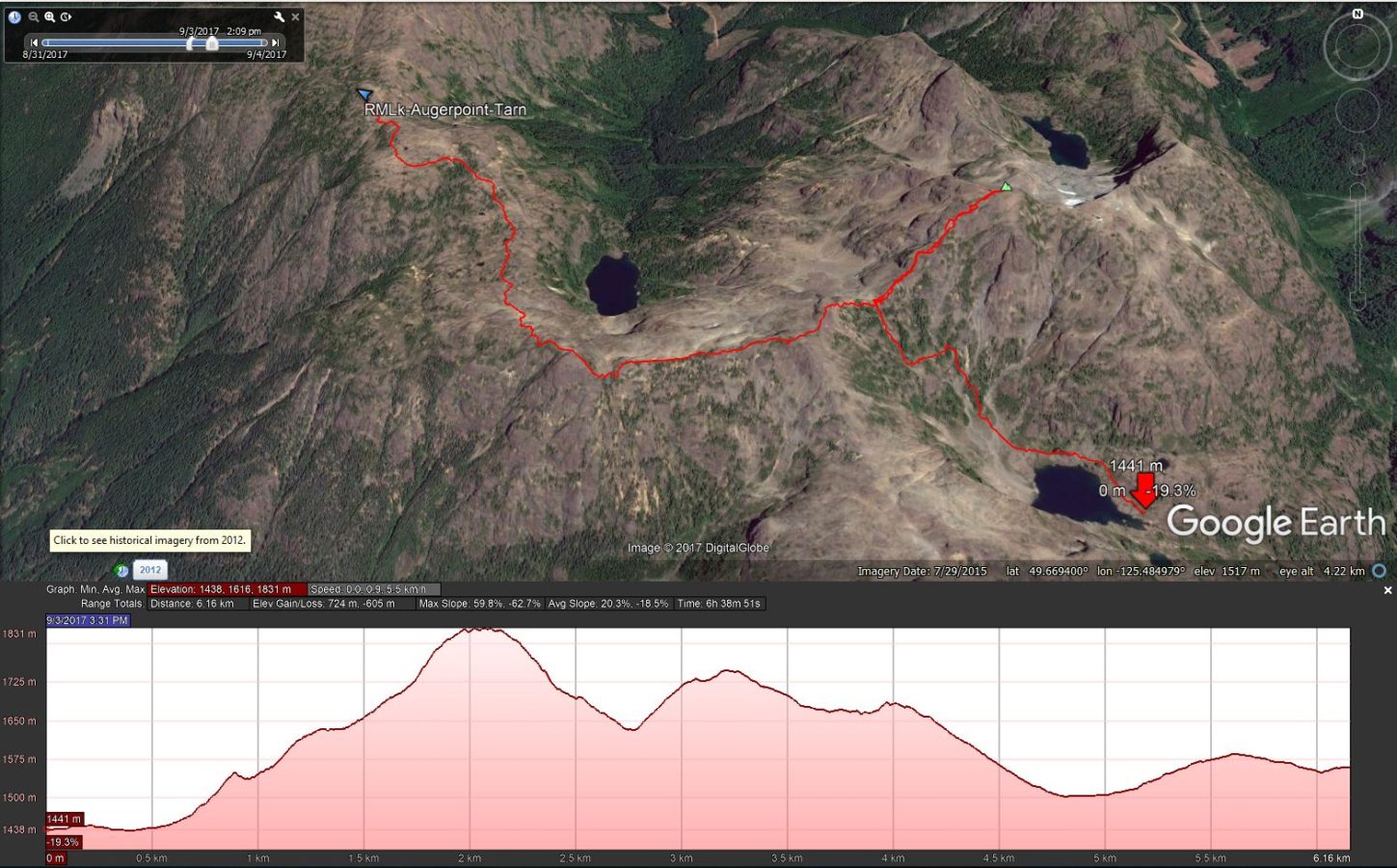
Day 4: Climb out of valley to saddle below Augerpoint Mtn. Switch to daypacks to summit Augerpoint. Return to saddle, retrive backpacks and continue to camp at one of the tarns below NW Peak.
Topographical map and gpx file download at Gaia GPS.
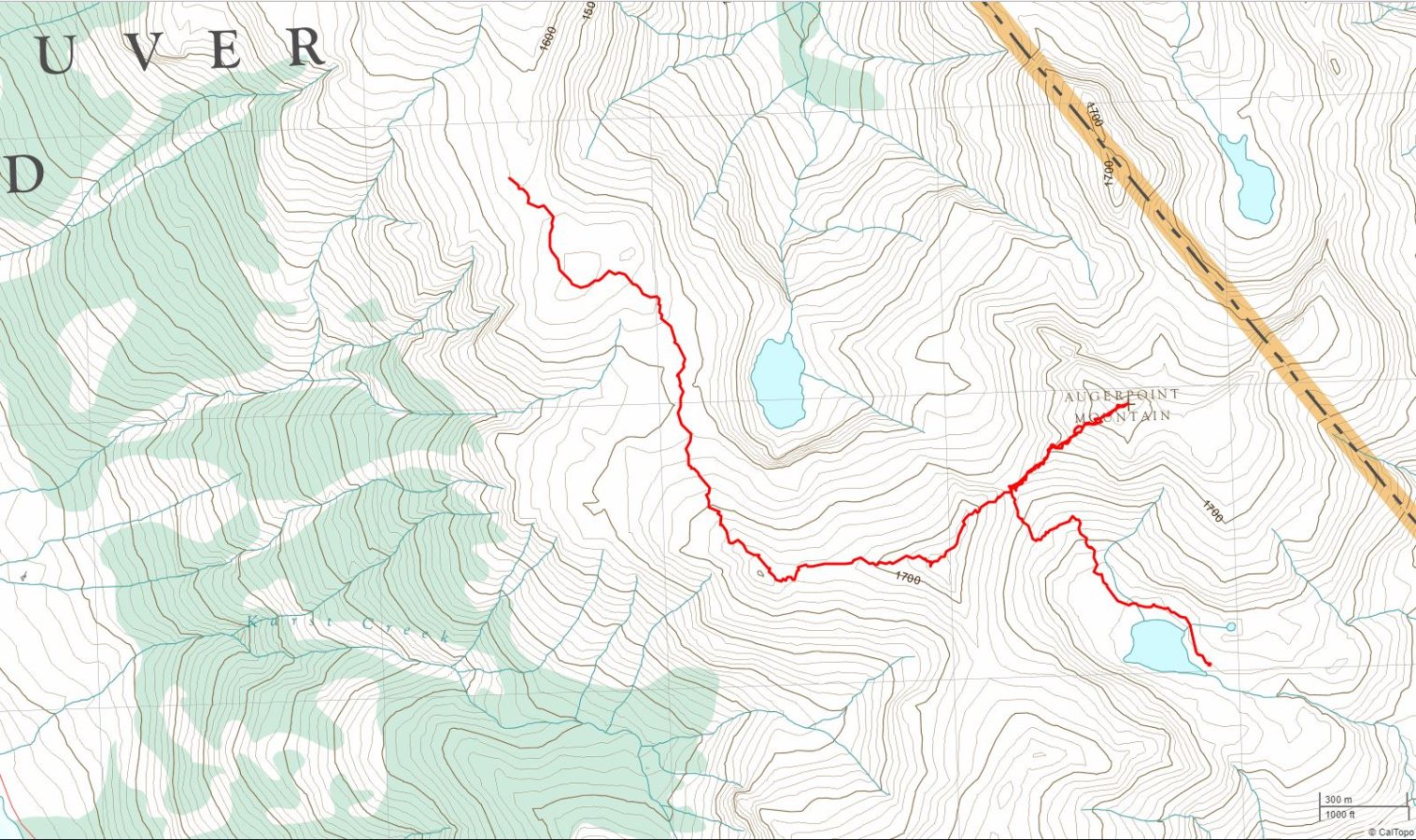
Day 5: Summit NW Peak with daypacks. Descend and retrieve backpacks and complete final descent to Buttle Lake.
Topographical map and gpx file download at Gaia GPS.
| Distance | 10.6 km |
| Elev. Gain/Loss | 480 m, -373 m |
| Max Slope | 33%, -26% |
| Avg. Slope | 8%, -6% |
| Difficulty Rating |
| Distance | 9.8 km |
| Elev. Gain/Loss | 1043 m, -356 m |
| Max Slope | 52%, -40% |
| Avg. Slope | 15%, -11% |
| Difficulty Rating |
| Distance | 7.3 km |
| Elev. Gain/Loss | 483 m, -931 m |
| Max Slope | 60%, -60% |
| Avg. Slope | 15%, -20% |
| Difficulty Rating |
| Distance | 6.2 km |
| Elev. Gain/Loss | 724 m, -605 m |
| Max Slope | 60%, -63% |
| Avg. Slope | 20%, -19% |
| Difficulty Rating |
| Distance | 8.5 km |
| Elev. Gain/Loss | 361 m, -1682 m |
| Max Slope | 41%, -70% |
| Avg. Slope | 13%, -24% |
| Difficulty Rating |
5040 Peak
A Summer Day Hike
Aug. 26, 2017

Topographical map and gpx file download at Gaia GPS.
| Distance | 7.1 km |
| Elev. Gain/Loss | 995 m, -995 m |
| Max Slope | 62%, -62% |
| Avg. Slope | 26%, -26% |
| Difficulty Rating |
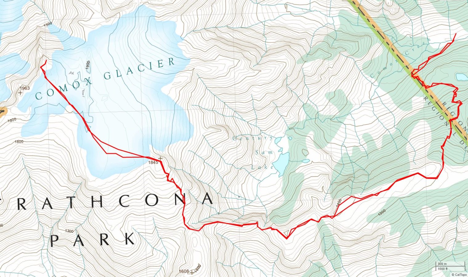
Comox Glacier (One Night)
An Overnight Summer Backpacking Trip
Jul. 29 – 30, 2017
Topographical map and gpx file download at Gaia GPS.
| Distance | 17.6 km |
| Elev. Gain/Loss | 2152 m, -2152 m |
| Max Slope | 65%, -65% |
| Avg. Slope | 22%, 22% |
| Difficulty Rating |
Ash Pond Loop (from Wood Mtn. Ski Area)
A Summer Day Hike
Jul. 13, 2017
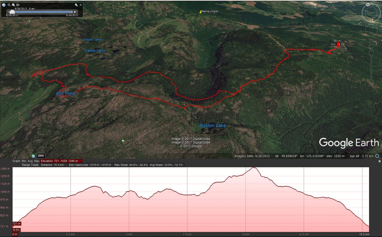
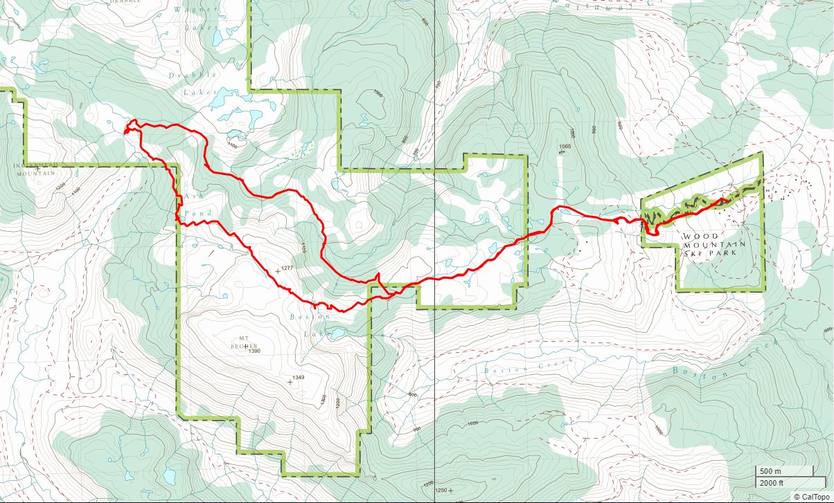
Topographical map and gpx file download at Gaia GPS.
| Distance | 15.3 km |
| Elev. Gain/Loss | 1015 m, -1015 m |
| Max Slope | 42%, -43% |
| Avg. Slope | 12%, -12% |
| Difficulty Rating |